A Moment in Time: Photographs of Quogue Village Streets, 1942

Dune Road, looking west
Dune Road, looking west. White tower of the Coast Guard Station, ca. 1912, in the distance. House on right, 111 Dune Road.

Along with founding families and historic houses, the streets of Quogue hold a special place in the character of the Village, laid out as they are in a shape reminiscent of a seashell.

Much thought went into both the layout, and the names, of the streets. Most of Quogue’s streets had been created in the 1870s and 80s, as Quogue rose in popularity as a seaside resort. In 1911, the Ladies Committee of the Quogue Improvement Association set out to elect a street-naming committee. It was the height of the boarding house era, and the Ladies Committee was responsible for keeping the village — advertised as the “Queen of the Hamptons” by the L.I.R.R. — living up to its reputation. At the helm were Mrs. Erastus Post and Mrs. David C. Townsend.

The name-less streets had been cumbersome to communicate, to say the least. “The New Road along the Beach between Bathing Stations” became Dune Road; “Andy’s Dock West to Howell Lane” became Quaquanantuck Lane. (Though some might say Quaquanantuck offered its own challenges.) Howell lane was later changed to Quantuck Lane. The street-naming committee recommended small wood signs painted with black letters on white ground to mark the newly named streets.

Archives, Russell V. Carman, Quogue Village Historian

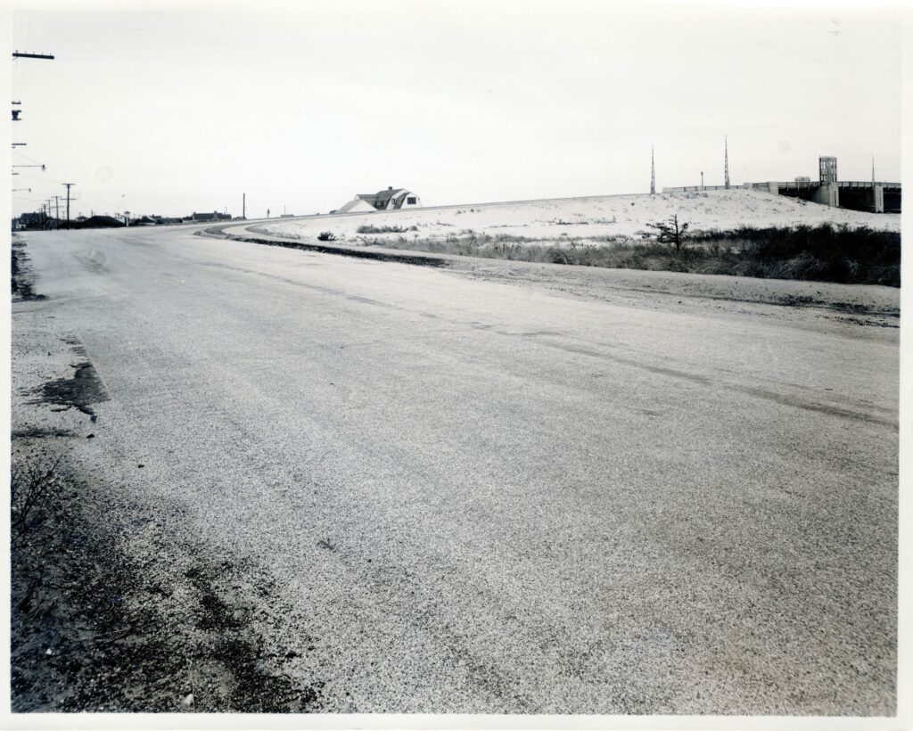
Two streets in Quogue’s history lost their importance, and the meaning of their names, in the Hurricane of 1938. The two bridges that linked the mainland to the Village beaches, on Ocean Avenue and Beach Lane, were washed out during the storm. The Village decided to build a single state-of-the-art drawbridge to access Dune Road, extending Post Lane over the Quogue Canal (and straight through the second nine holes of the Quogue Field Club’s golf course).

In February 1942, a Riverhead photographer, Louis Dormand, was hired to photograph the streets of Quogue, perhaps to document the new Post Lane bridge, which had opened in 1940. Dormand took ten photographs in the winter of 1942, capturing street scenes very different than those of today.

Quogue Street , looking east. Church of the Atonement, ca. 1883, on right. “Willowood,” mid-18th century, and “Tanglewood,” mid-18th century, on left.
Quogue Street and Post Lane, looking south. “Clovercroft,” ca. 1889, and “Crossroad Cottage,” ca. 1890, on right. “Slumberside,” ca. 1894, built for Admiral Alfred T. Mahan, on left.
Post Lane, looking south toward roundabout at Niamogue Lane and bridge.
Niamogue Lane-Post Lane roundabout, looking east. Quogue Field Club golf course, post-1938 Hurricane, on right. House in the center built by Abram S. Post, ca. 1890. House at left, # 11 Niamogue was built ca. 1928.
Quogue Street, looking west. “Miss Mary Post’s Cottage,” mid-18th century, “Hermitage,” ca. 1890, and Cooper House Annex, on right. On left, 67 Quogue Street, ca. 1907, Quogue House, Presbyterian Chapel, ca. 1868, and “Fieldmouse,” ca. 1890.
Quogue Street at Post Lane, looking east. Capt. Henry Gardiner house, ca. 1820, on right. “Bonnyfield,” ca. 1886, and “Zephyros,” ca. 1888, on left.
Montauk Highway and Quogue Street, looking west. “Narioch,” ca. 1890, on right, and “Bella-Mar,” on left. Designed by architect Isaac Green and built as a single home, ca. 1894, the house was split in the early 1960s (now 107 & 109 Quogue Street).
Dune Road, looking east. The new Post Lane bridge on left in the distance.
Post Lane bridge, south side, looking west down Dune Road. House in center is 106-108 Dune Road.
Dune Road, looking west
Dune Road, looking west. White tower of the Coast Guard Station, ca. 1912, in the distance. House on right, 111 Dune Road.